Thursday, 21 July 2016

The Oodnadatta Track

Sunday 17 July
When I look at a map and see a dashed line indicating a dirt road, I think pot holes, bull dust or large muddy puddles, corrugation and top speeds of 50 kph. However, right now the Oodnadatta Track is not that.
We'd packed up super fast after a frosty morning in Uluru and were on the road by 8am. We made Marla, over the SA boarder for lunch and shared a picnic table with a FTO3m (Family Time Out for 3 months) who'd just come up the Track. They said that the recent rains had left the track is a beautiful smooth condition, and that's all it took to convince Evan that the Oodnadatta Track was the way home.  He also thought or hoped that the suspension on the camper could handle it, so our destination for the night was now William Creek, 180km east of Coober Pedy.
The FTO were right, we were cruising the dirt at 90 kph with the salt bush plains stretching on for miles with not a tree in sight. The rains had brought fields of flowering white daisies beside the road. Flocks of corellas lifted from the pool of the flat salt lake pans and as the sun set we arrived at William Creek, a one pub 'town' with a runway and a caravan park. This is what we'd been missing. So glad to be away from the crowds and tourists at the Red Centre.


This is a very historic part of the country.  The Ood or The Dat Track follows the old Ghan railway line and all the ruined sidings and buildings to go with it. We spent today slowly making our way south with many stops along the way to collect railway nails, explore old ruins, climb water tanks, squelch through the salt crusted bed of Lake Eyre, up to our ankles in mud. We made Marree for lunch and stopped in at the Lake Eyre Yaught Club. Yep, this old dude had a catamaran and whenever there is more than 80mm of water in the lake he goes sailing, sometimes for days or weeks at a time, towing a canoe with all his supplies!
Back on the road and there is a tiny little ruined town called Farina which some oldies are trying to restore. There is an old bakery with oven built underground and they have the bakery up and running. We stopped in for a pie, cinnamon scroll and an amazing custard tart. It's in the middle of nowhere but hopefully they get the passing tourists on their way to the Strzelecki, Birdsville and Oodnadatta tracks.
The further south we drove the hillier the country became with the beginning of the magnificent Flinders Ranges to our left. There were also a few flocks of emus, sheep and finally some trees.
Parachilna is another blip on the map with a pub and an old school house, turned 'caravan park' ie there's a toilet/ shower block and gas BBQ. We're here for the night with 4 other people and it's nice that there's no white noise of a generator, like we'd been getting used to in the 'overflow' camp sites.


Kata Tjuta

For our final day in the Red Centre we headed out to Kata Tjuta, or the Olgas, 50 km west of Uluru. It was another chilli, clear day with a very cold wind, which is not ideal for walking along gorges, with rock walls and no sunlight. We also didn't have the energy to do the 4 hr Valley of the Winds walk which also sounded just too bloody freezing, but we walked up to the first lookout to see the orange domed rocks.
The best part about the day was definitely seeing those rocks. Kata Tjuta are not made up of the same course grained sandstone as Uluru as I had expected. Kata Tjuta is made of the biggest conglomerate I have ever seen! Towering up into the sky. With small pebbles up to large boulders measuring half a meter of basalt and granite. Now let's just stop for a minute here and think about the earth surface processes which  made these landforms, stay with me.

Some time, a very long time ago, there was a volcano. Deep in its chamber granite was formed and it then spewed out basalt. Once these rocks had formed, piece of these rocks found themselves in a river, a very fast flowing river, probably flowing down a large mountain, which made them into pebbles, knocking off their corners and smoothing them. We also know that it was a fast flowing river by the size of the rocks which were able to fall from suspension, out of the flow. Then, over millions of years, the river sediments become the conglomerate rock. Fast forward a few more million years and the conglomerate gets uplifted, cracks form, water seaps through the cracks and erodes the dome shapes we see today, in the middle of the desert. Geological time blows my mind.
And most people are like, 'nice rock, now let's get back to the hotel for the WiFi'


Uluru

Friday 15 July

There's a lot more traffic once you hit the Lasseter Highway. After all, Uluru is what people are here to see in the Red Centre. The dirt had slowly been turning more and more red as we headed south out of Kings Canyon into a landscape of grass covered sand dunes with desert casuarina. Once you head west the spectacular Mt Connor emerges from the southern plains with its flat messa top, and finally a bit further west, there she is the giant orange rock in the desert, Uluru.
Yesterday we went and watched the colours change against the rock as the sun set. The gullies casting shadows, grey lines where water seeps, diagonal sedimentary bedding planes. How on earth did this monolith get uplifted on its side and now be the only thing remaining in a sea of red sand?
We spent today exploring around the Rock in the bright sunlight and an icy cold wind. We joined a group with a Ranger on the Mala walk. He told us all about the Aboriginal people from the area and how they used caves, waterholes and sacred places. He also told us that because Uluru is a sacred place to the Aboriginal people that no one should climb it. Luckily the climb was closed today due to high winds at the summit so the decision of not climbing was already made. The path up the side also looked quite hairy with a metal chain going up to the sky and I was glad I wasn't taking the boys up there.

In all the national parks we've visited this trip there have always been signs about the Aboriginal culture and the significance of the areas, however, none of the rangers we've met, looking after the parks and running the educational talks and programs have been Aboriginal, which I think is a bit disappointing. If these places are so important to them, why aren't they the ones looking after them and sharing their culture with us?

As you drive up to Uluru it just gets bigger and bigger. You really just have to stand there a minute and take it all in. The base of the rock is a lot more beautiful than I'd expected. Close up, the orange cliffs, that look like they've been cement rendered, tower above you and you can see grasses and figs and other plants clinging on to cracks and pieces of rock that look like they're about to come crashing down. Maybe in a few thousand years, or maybe tomorrow. In some parts of the base of the rock there are piles of boulders and others there are wave shaped caves with rock art. There are native desert plum, wattle and bloodwood. There are also two pools of water which were beautifully clear and quite full from rain two weeks ago.
We really wanted to ride bikes around the 10km base track, however the bikes for hire were all booked out. Lloyd and Rex had their bikes with them so they had a short ride.
To finish the day we drove all the way around in the afternoon light to get a few more photos.


Kings Canyon

Wednesday 13 July

After a couple of nights back at the Scout centre in Alice Springs, several showers and many loads of washing we said farewell to the Scout people and put Beth on a plane home. We're going to miss her. We bought our permit for the loop road, west of Alice and were on our way to Kings Canyon. The 200km of dirt road was in pretty good condition with only a bit of corrugation, but I kept checking the wing mirror to see if the camper trailer was still there.
 

 There's not much around Kings Canyon in the way of a town and we found ourselves camped at the "Resort". It seems that in the Territory if a caravan park has motel accommodation, some kind of restaurant/bar and a pool it can call itself a "Resort" but really it's just a caravan park.
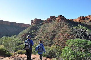
We've seen some pretty spectacular scenery over the past couple of weeks. Trephina Gorge was amazing and then there was a whole other level with Ormiston Gorge. Kings Canyon turned out to be Trephina, Ormiston, Karijini and the Bungle Bungles all rolled into one! Towering red sandstone cliffs against the blue sky and once you walk up the track to the plateau and the ring walk you find yourself wandering amongst layered sandstone domes. But don't wonder too far off the track or you'll find yourself at the cliffs edge. The boys had a great time climbing and exploring, following the blue track arrows, finding ancient ripples in the rock. These rocks are much younger than the West Macdonald Range at 400 million years old and are thought to be ancient dunes and shallow lakes. During our walk I didn't see any signs of fossil.
Halfway around the loop the track decends down some steep wooden stairs into the "Garden of Eden" with rock figs, ghost gums and cycads along a creek with water in it, thanks to the recent rains. Further along this smaller part of the gorge it opens out into a large deep pool surrounded by rock walls. This reminded me of a pool at one end of Dale's Gorge in Karijini NP in WA. This place has it all. Back up on the rim the chilli wind kept us moving but the domes on this side of the gorge were not as spectacular.
The boys did very well walking the 7km around the top of the gorge followed by the Ranger walk along the creek in the afternoon.
All in bed by 8pm tonight.


Saturday, 16 July 2016

The Larapinta Trail

Tuesday 6 to Sunday 10 July

It's had been a while since I last properly  hiked. In fact, I can't even remember the last time I carried a full hiking pack for several days with food, water, tent, stove, sleeping bag etc. I'd forgotten just how heavy it can be and where I can comfortably run 10km in an hour it takes three times as long when you're lugging 12kg to 15kg on your back.

Our group of about 30 Scout people left the Scout hall in Alice on Tuesday morning. Our group was made up of people from 2/3 Lindfield, 1st Glossodia and West Pennant Hills Valley. Most of the group were getting a bus transfer to Ormiston Gorge, however we left a little earlier so we could stop in at Simpson's Gap, another spectacular break in the red rock range, but this time in the West Macdonald Ranges, not far out of Alice Springs.
Once we arrived at Ormiston camp ground we set up camp in the coach area and Ma Grylls and I went with the boys up to the Ghost Gum lookout. You walk up a winding path to overlook the Gorge where there is a lone Ghost Gum, it's white silhouette illuminated in the afternoon light against the red cliffs. As you come up the last few steps you look up and the immensity of the gorge takes your breath away. Blue sky, red towering cliffs, dotted with green from the recent rains, down to the white sand of the river bed, with dark pools of water. I thought Trephina Gorge was spectacular but the size of this is something else.
On the Wednesday morning we all put on our day packs and set out to walk the 7km around Ormiston Pound. First following the river, then up into the Hills to a lookout, giving a view east of the gorge along the Range. Then back down to the river to follow it through the bedrock confined gorge. A lot of the path is over a rocky scree of 800 million year old mudstone, limestone and dolomite, dotted with green spinifex. Once down along the river, there is more rock hopping and in parts it is tricky navigating the diagonally uplifted bedrock. The river exists in pools and then you reach a point where you can go no further because of the deep pool and the red cliffs on either side. We'd know this was coming from passing hikers but now we could hear the squeals of the people ahead of us as they forded the icy water, waist deep. Rex and Lloyd thought they might like a swim, however, changed their minds after putting a foot in and were carried across. The water was so cold it hurt but there was only one way, forward. After that experience, we were now luckily almost back to camp and I was very impressed how well Rex and Lloyd had walked all day as there has been quite a few hills. It was the perfect way to ease us all into the hike ahead.

Wednesday 7 - Sunday 11 July
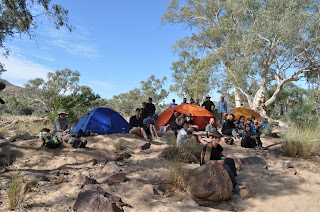
The next few days we hiked west, sections 10 and 11. It was Scott's 10th birthday so after a morning tea of steamed chocolate cake made on the gas BBQ and being presented with the Birthday Wig of Happiness we were packs on and on our way. Evan took Rex and Lloyd with the camper trailer onto Redbank, our final destination and Scott and Beth hiked with me. The Larapinta trail took us over rocky hills, over sandy river beds, up a huge mountain which never seemed to end and almost broke us, through mallee scrub, all the while following the West Macdonald Range. We camped at Finke River, Rocky Bar Gap (with terrible sand flies) and finally at the end of three days of walking we made it to Redbank, where Evan had prepared for us a roast dinner cooked in 3 camp ovens on the camp fire. The meal was devoured.

For the final day, we were all up at 5am with head torches on and stumbled up hill towards Orion to see the sunrise from Mt Sonder, the highest mountain in the NT. We saw the sunrise just after 7am and as the dawn light crept across the land, hills and rivers and ranges were revealed far below. However, we still had another hour and a half walking up hill until we reached the summit. We were so high up. The land marks from the previous days were dwarfed below us and to the east we could see where we had come, 60km to Ormiston Gorge. The two and a half hours coming down hurt my knees but every time I looked up from my feet there was that view. The perfect end to an amazing trail.